 Many of us have been rescued from unfamiliar territory by directions from a Global Positioning System (GPS) navigator. GPS satellites send signals to a receiver in your GPS navigator, which calculates your position based on the location of the satellites and your distance from them. The distance is determined by how long it took the signals from various satellites to reach your receiver. The system works well, and millions rely on it every day, but what tells the GPS satellites where they are in the first place?
"For GPS to work, the orbital position, or ephemeris, of the satellites has to be known very precisely," said Dr. Chopo Ma of NASA's Goddard Space Flight Center in Greenbelt, Md. "In order to know where the satellites are, you have to know the orientation of the Earth very precisely."
Just as you can use landmarks to find your place in a strange city, astronomers use landmarks in space to position the Earth. Stars seem the obvious candidate, and they were used throughout history to navigate on Earth. "However, for the extremely precise measurements needed for things like GPS, stars won't work, because they are moving too," says Ma.
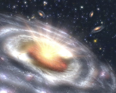
Most quasars lurk in the outer reaches of the cosmos, over a billion light years away, and are therefore distant enough to appear stationary to us. For comparison, a light year, the distance light travels in a year, is almost six trillion miles. Our entire galaxy, consisting of hundreds of billions of stars, is about 100,000 light years across.
0 comments:
Post a Comment